(for more about Power Words, click here)
coral Marine animals that often produce a hard and stony exoskeleton and tend to live on the exoskeletons of dead corals, called reefs.
drought An extended period of abnormally low rainfall; a shortage of water resulting from this.
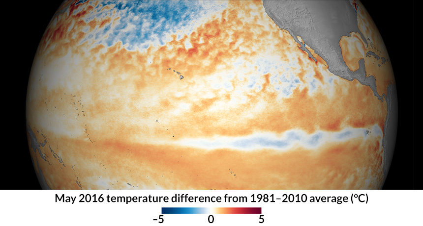
El Niño Extended periods when the surface water around the equator in the eastern and central Pacific warms. Scientists declare the arrival of an El Niño when that water warms by at least 0.4 degree Celsius (0.72 degree Fahrenheit) above average for five or more months in a row. El Niños can bring heavy rainfall and flooding to the West Coast of South America. Meanwhile, Australia and Southeast Asia may face a drought and high risk of wildfires. In North America, scientists have linked the arrival of El Niños to unusual weather events — including ice storms, droughts and mudslides.
equator An imaginary line around Earth that divides Earth into the Northern and Southern Hemispheres.
hurricane A tropical cyclone that occurs in the Atlantic Ocean and has winds of 119 kilometers (74 miles) per hour or greater. When such a storm occurs in the Pacific Ocean, people refer to it as a typhoon.
La Niña Extended periods when the surface water around the equator in the eastern Pacific cools for long stretches of time. Scientists will announce the arrival of a La Niña (lah NEEN yah) when the average temperature there drops by at least 0.4° C (0.72° degree F). Impacts on global weather during a La Niña tend to be the reverse of those triggered by an El Niño: Now, Central and South America may face severe droughts while Australia floods.
National Oceanic and Atmospheric Administration, or NOAA A science agency of the U.S. Department of Commerce. Initially established in 1807 under another name (The Survey of the Coast), this agency focuses on understanding and preserving ocean resources, including fisheries, protecting marine mammals (from seals to whales), studying the seafloor and probing the upper atmosphere.
reef A ridge of rock, coral or sand. It rises up from the seafloor and may come to just above or just under the water’s surface.
weather Conditions in the atmosphere at a localized place and a particular time. It is usually described in terms of particular features, such as air pressure, humidity, moisture, any precipitation (rain, snow or ice), temperature and wind speed. Weather constitutes the actual conditions that occur at any time and place. It’s different from climate, which is a description of the conditions that tend to occur in some general region during a particular month or season.


