Is Hurricane Florence one sign of new climate trend?
Such rapidly strengthening storms pack surprising power

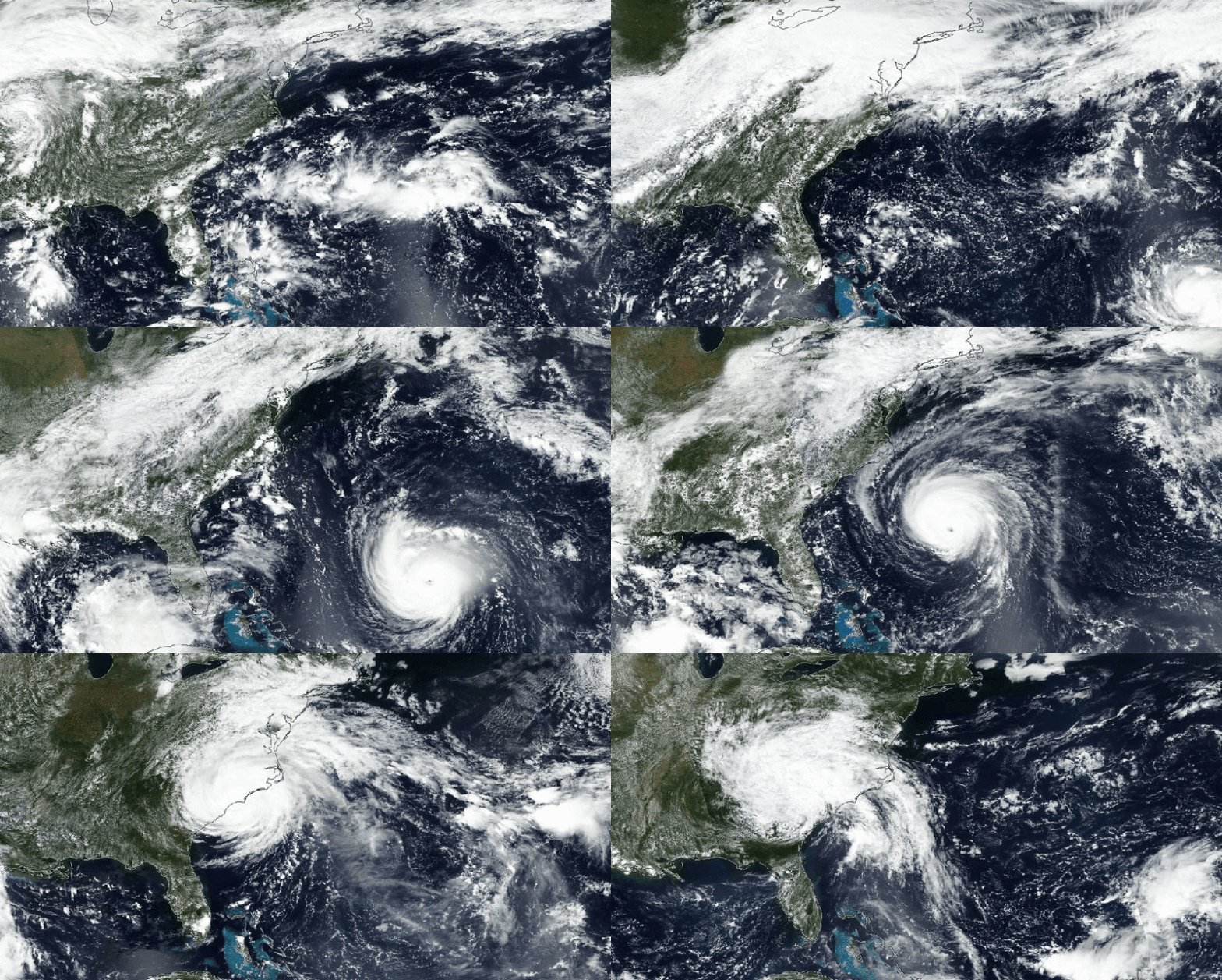
This NASA satellite image shows Florence as the hurricane approaches the U.S. coast and makes landfall on September 14, 2018.
NASA Worldview
Florence began humbly. It was born off the West Coast of Africa on September 1, 2018 as a little cluster of thunderstorms. Within a short time, this weather system had stolen enough energy from the ocean to reach tropical storm strength. It would go on to blow through the Atlantic for two whole weeks, wreaking havoc on the Carolinas. In the end, it ranked as one of the year’s longest-lived cyclones.
The National Hurricane Center is in Miami, Fla. On September 3, its meteorologists first talked of the storm’s potential to strengthen rapidly. What does that mean? Its rotating winds would have to increase in one day by 55.5 kilometers (34.5 miles) per hour.
Scientists suspected Florence would do this because the cyclone was going to move into a region where winds in the upper atmosphere were weak. That would keep them from tearing apart the fledgling storm. Temperatures at the sea surface also were unusually warm. This provided lots of water vapor. That’s the ideal fuel for strengthening a storm. In automotive terms, the atmosphere was all gas and no brakes.
However, the cyclone also had been moving through a region with strong wind shear before this. The speed and direction of those turbulent spinning winds can change abruptly with height. Such shearing winds risked pulling Florence apart. So at one point, Florence looked like it might peter out as a little more than a hurricane wannabe.
Instead, the Category 1 storm explosively powered up on September 4, just as the hurricane center had predicted. The once infantile storm strengthened into a Category 4 within just one day. Winds now swirled around its core at 209 kilometers (130 miles) per hour. And then, just as suddenly, Florence appeared to fall apart. It was downgraded to a tropical storm on September 7.
But air to the west of this storm was a powder keg of energy. And a weirdly shaped system of high air pressure known as the “Bermuda High” remained parked over the central Atlantic. It acted as a guardrail that steered the storm into a mass of super-moist air. (Scientists joked that this air was “juicy.”)
Once more, the storm speedily strengthened. By September 9, Florence was back to a Category 4. And now its winds were howling at a whopping 225 kilometers (140 miles) per hour.
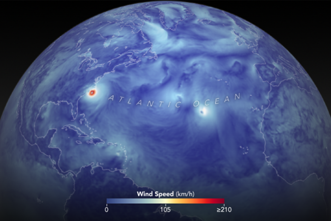
Such rapid strengthening of hurricanes seems to be a relatively new phenomenon. This happened to storms in the past. But now it seems to be occurring much more frequently. Last year’s Hurricane Harvey was such a storm. Weeks later, Hurricane Irma revved up into one, too. And in a two-day period in September 2017, Maria blossomed from a mere tropical storm into a Category 5 beast.
Researchers are exploring what’s behind such rapidly strengthening cyclones. Some have begun to suspect that our warming climate may play a role.
Why storm behaviors are so hard to predict
The National Hurricane Center is responsible for studying all Atlantic cyclones. Its scientists coordinate with governments and others across the Caribbean and the entire Atlantic basin. And if there’s anything that all these experts have learned, it’s that it is very hard to forecast hurricanes well.

But that hasn’t stopped meteorologists from trying — and succeeding. They’ve learned that collecting huge masses of real-time storm data is key.
Their work starts when satellite images pinpoint a disorganized blob of shower and thunderstorm activity somewhere in the middle Atlantic between 10 and 25 degrees north latitude. The hurricane center dispatches expert pilots and meteorologists to take a look. They team up with the U.S. Air Force to fly specially equipped turboprop planes into the storm. These airborne storm chasers will brave winds exceeding 290 kilometers (180 miles) per hour to track a cyclone’s behavior and path.
Instruments on board send back readings of temperature, wind speed, wind direction, humidity and air pressure. With these data, the storm experts start to explore the chance these thundershowers will grow into a system that could eventually grow into a hurricane. And they will continue to track a storm’s evolving traits throughout its life.
Meteorologists are trained as atmospheric physicists. They use computers and complex math to describe — and then probe — the movement of gases and water droplets in the atmosphere.
In Miami, the hurricane center’s meteorologists use the data collected directly inside and outside of a storm. They’ll pump some of these data into computer models. These will process billions of data points in a far shorter time than it would take people to crunch all of those numbers.
Forecasters use the computer-processed real-time data and observations to make an educated guess about how the storm will behave within the next few hours to days. Where will it go? How strong will it be? Accuracy matters when countless lives and billions of dollars worth of property may be at stake.
Scientists have a pretty good idea where a cyclone will move over the next half day. Its predicted path will tend to be off by no more than about 47 kilometers (30 miles). But as forecasts move further into the future, their predictions become much less certain.
Five days out, a storm’s projected path could be off by some 350 kilometers (220 miles). Or it could be fairly accurate. The five-day forecast of Florence’s landfall, for instance, was off by only 24 kilometers (15 miles).

Behaviors that affect a cyclone’s power are harder to predict. One reason: They can be greatly affected by what’s happening in the upper atmosphere. That’s a region scientists’ tools cannot easily observe. Experts have therefore turned to computers, asking them to “model” what they think occurs there.
But those models sometimes fall short. For instance, they don’t show precisely how air exits the eye of a hurricane to flow over and out of a storm. Yet what happens in that zone may affect how quickly a cyclone’s speed ramps up.
Getting a better understanding of rapidly strengthening storms could help in forecasting most intense hurricanes. That’s because the strongest cyclones are likely to undergo such a rapid supercharging. This was the conclusion of a 2016 study in Nature Communications.
Chia-Ying Lee led it. She’s a climate modeler at the International Research Institute for Climate and Society. That’s at Columbia University in Palisades, N.Y. Her team looked at all major cyclones across the globe between 1981 and 2012. They found that nearly eight in every 10 major cyclones now strengthen rapidly at least once in a storm’s lifetime.
The potential role of a warming change
Some scientists think that climate change will make this behavior even more common. Among them is Kerry Emanuel at the Massachusetts Institute of Technology, in Cambridge. He suspects future Atlantic hurricanes will become increasingly dangerous.
His own analyses, he has written, suggest that over the next 80 years, the share of storms “that intensify rapidly just before landfall could increase substantially.”
There is science to support why that makes sense.
Rivers of air in the upper atmosphere blow from west to east. Known as jet streams, they form at the boundary between warm and cold air.
Dry air heats up faster than moist air. This explains why the dry air at Earth’s poles has been warming faster than at the equator. That unequal warming can slow the jet stream. Such a slowing, in turn, tends to weaken steering currents within the jet — those winds that push weather systems.
Weaker steering currents could impact how quickly a hurricane moves. If one lingers over an area of very warm water, it now risks strengthening explosively, Emanuel observes.
Because such a rapid revving up of a cyclone’s speed is difficult to forecast, he says there is a risk that in the future, many hurricanes could make landfall with little long-term warning to affected communities. And this, he adds, could lead “to higher rates of injury and death.”
However, scientists are not yet certain of any of this. Records of storms date back to the 1800s. However, satellites have only been watching hurricanes for the past several decades. Today they allow meteorologists to watch less-powerful tropical systems in remote areas that people likely would have missed in the past. And that makes it tough to know for sure how many storms spun up in years before today’s accurate detection methods. So while some scientists assert that the overall number of storms is increasing, it’s impossible to know for sure. That complicates issues surrounding research into the rapid strengthening of cyclones.
In the future, will more storms rapidly rev up to become whoppers? We’ll just have to wait and see. And, of course, keep studying the details of how and where they develop.


