Silk Road’s origins may date back millennia
Seasonal migrations of nomadic herders marked early steps in establishing this trade route

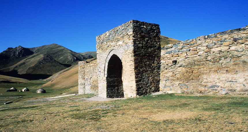
Herders in Asia forged high-altitude travel routes that became part of an ancient trade network known as the Silk Road, a new study concludes. This Silk Road inn, near an ancient herder route, is some 3,500 meters (11,000 feet) above sea level in Kyrgyzstan, near the Chinese border.
M. Frachetti
Share this:
- Share via email (Opens in new window) Email
- Click to share on Facebook (Opens in new window) Facebook
- Click to share on X (Opens in new window) X
- Click to share on Pinterest (Opens in new window) Pinterest
- Click to share on Reddit (Opens in new window) Reddit
- Share to Google Classroom (Opens in new window) Google Classroom
- Click to print (Opens in new window) Print
By Bruce Bower
Nomadic herders took the ancient Silk Road to new heights. Starting 4,000 years ago or more, Central Asian herders routinely moved from highland pastures in summer to lowland areas in winter. Over roughly the next 2,000 years, those routes became a key part of the Silk Road, a new study contends.
The Silk Road is an ancient trade and travel network. It stretched from China to Europe. It gets its name from the silk traders who traveled its paths more than 2,000 years ago. Extensive Silk Road pathways ran across Asia by that time. Merchants, pilgrims, monks and soldiers traveled these routes, as did nomads. But those paths may be far older, says a team led by Michael Frachetti. He’s an anthropologist at Washington University in St. Louis, Mo. His team published its findings March 9 in Nature.
The traditional view of nomadic groups is that they were barbarians. But the new paper supports a growing belief among researchers that traveling herders contributed to the rise of early states and civilizations, says William Honeychurch. He is an archaeologist at Yale University in New Haven, Conn.
Frachetti agrees. The Silk Road goes through a mountainous part of Central Asia without cities. This area stretches from what’s now western China to Afghanistan and Pakistan. Thousands of years ago, highland routes made it possible for travelers from many lowland centers to journey across the continent. Contacts among highland herders and lowland populations eventually led to cradles of civilization in China and elsewhere, Frachetti suspects. “Silk Road highland networks were formed by pastoralists,” he says. (Pastoralists are people who make a living by raising livestock.)
He suspects that these herders would have interacted “with other groups in a lengthy process that was not a construction project and involved no planning.”
Travel routes out of the mountains varied from year to year. Where the herders moved around would have depended on where the best grasslands were at that time. That means that herders didn’t always beat clear-cut paths into the turf. But Frachetti thinks that ancient herders built stone structures and other landmarks as travel guides. These also would have provided directions to outsiders venturing through Central Asia’s mountains. Some of these landmarks still exist.
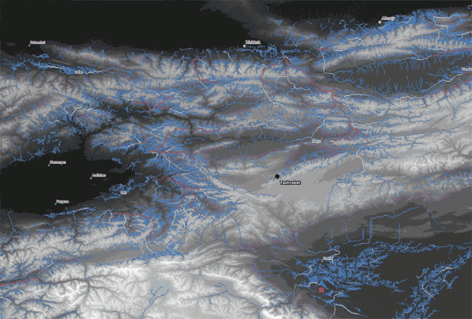
Story continues below map

Mapping out long-ago paths
Ancient herders would have spent warm summers at highland locations. These likely would have ranged from 750 to 4,000 meters (2,500 to 13,000 feet) above sea level. As the seasons turned cold, they would have then descended to warmer lowlands. Frachetti’s group started with satellite imagery of the Silk Road region and land-mapping software. These let them create 500 computer simulations of routes that roaming highland herders could have moved across as the seasons changed. Those simulations represented 500 years of seasonal treks.
The scientists based their simulations on modern knowledge of vegetation and climate fluctuation in Central Asia. Those data are similar to what’s known about conditions in Central Asia several thousand years ago, Frachetti says. The routes favored by the simulations were those that would have provided the best pastures for grazing animals from year to year.
The researchers used math to fold all 500 simulations into one overall route. A small number of paths that frequently popped up in single simulations largely shaped that path, Frachetti says.
This route also intersected with 192 of 258 known Silk Road archaeological sites at high altitudes. Those sites weren’t always exactly on the route, though. The team allowed for a leeway of 2 kilometers (1.2 miles). Since simulated routes often ran through grassy pastures, travelers’ inns and other structures were probably built nearby, the scientists reasoned.
The role of nomads in helping establish the Silk Road needs to be explored further, Honeychurch says. Scientists should look for more highland sites that seem to fall onto ancient herders’ simulated travel routes.
Herders would have trekked in certain directions to avoid dangers and for many other reasons, he cautions. That means people would have been guided by more than just the need for pastures and water, he explains.


