Super-tiny pollutants may help fire up fierce storms
Under the right conditions, ultra-small particles can help create clouds and winds

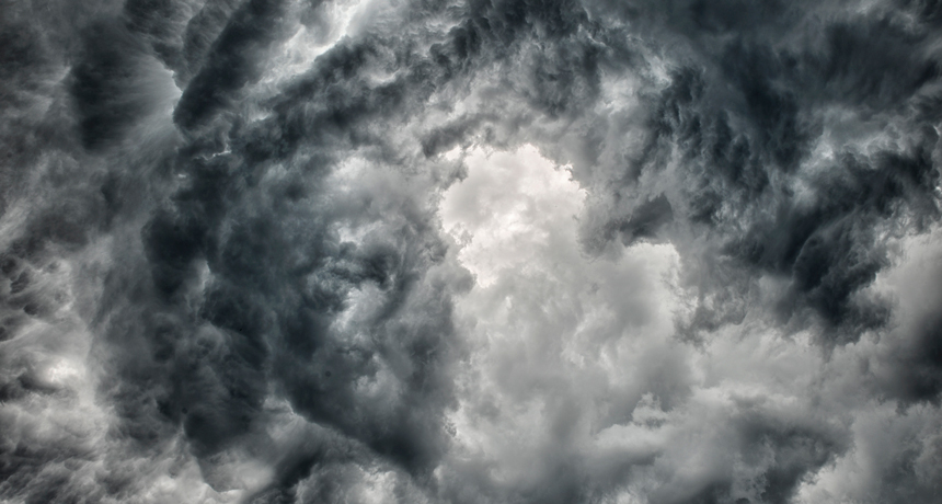
Very small air pollutant particles may help power up storms in the Amazon rainforest, a new analysis finds.
Courtesy of Montanus Photography
Teeny-tiny particles in the air can make storms stronger, new research suggests. This is especially true over places where the air starts out relatively clean, such as over the oceans or in the Amazon rainforest. A passing plume of the tiny pollutants in these places can make a storm up to 50 percent more intense.
That’s the conclusion of a new computer analysis.
The smaller an air pollutant particle is, the longer it can remain aloft in the air. And the longer it stays in the air, the farther it can travel. Such small particles are known as ultrafine (meaning super small) aerosols. Each will be less than 50 nanometers — billionths of a meter — across. (For perspective, a human hair may be 80,000 to 100,000 nanometers wide.)
Such nanopollutants spew from a wide range of sources. These run the gamut from car exhaust and wildfires to printer toner. When inhaled, these tiny pollutants can cause harm to the body and brain. When drawn into the atmosphere, they can alter the weather.
Fairly large air-pollutant particles can help form clouds. But scientists used to think the ultrafines were too small to do that. New research suggests that’s wrong. Ultrafine aerosols indeed may help drive storms in the Amazon and elsewhere. That would mean they may play a big role in how water (the basis of storms) moves across the planet.
“I have studied aerosol interactions with storms for a decade,” says Jiwen Fan. She’s an atmospheric scientist who led the new study. She works at the Pacific Northwest National Laboratory in Richland, Wash. “This is the first time I’ve seen such a huge impact” from these tiniest particles, she says.
Her team shared its findings January 26 in Science.
How to make a cloud
Particles such as soot are quite tiny. Still, they’re far bigger than ultrafine aerosols. Sooty bits are more than 100 nanometers across. They can help create clouds by allowing water vapor to condense onto them. This begins the formation of tiny water droplets. When enough of them get together, they turn into a cloud that we can see.
But water vapor has a far harder time condensing around tinier particles. For that, the air must hold even more water vapor than normal. This waterlogged air is described as supersaturated.
It rarely occurs. Usually, the air hosts plenty of larger aerosols. Water droplets form around these before the air gets a chance to become supersaturated. Explains Fan, those larger pollutant bits in air remove the extra water. Yet supersaturation can be relatively common at humid sites with little air pollution, she notes. The Amazon rainforest is one such place.
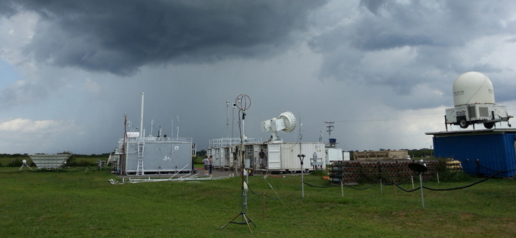
Brazilian and U.S. research groups worked together to study weather and pollution in that rainforest from 2014 to 2015. As part of that, several observation sites tracked polluted air that drifted across the rainforest. Such a traveling cloud of pollution is called a plume. And the plumes, here, came from Manaus. It’s an industrial city that is home to 1.8 million people.
Story continues below image.

During the Amazon’s warm, wet season, the rainforest’s weather seldom changes. Temperature, humidity and wind direction all stay much the same from day to day, Fan says. Here, then, an occasional pollutant plume tended to be the only major change.
The researchers observed such plumes at one research station there between March and May in 2014. They also looked at vertical winds, known as updrafts. When a large plume with lots of ultrafine aerosols passed by, the researchers saw heavier rains and stronger updrafts. Such winds tend to make storms more intense.
Next, the researchers used a computer to model, or simulate, an actual storm that had occurred on March 17, 2014. They fed the computer model data on that storm’s temperature, wind and moisture levels. They also included pre-storm data on the low level of pollution before the plume came by. Then, the team ran the simulation several different ways. In one scenario, there was no pollution plume. In another, there was a passing plume typical of what might be coming from Manaus.
The results suggested that the ultrafine aerosols not only helped clouds form but they also created water droplets. And those would greatly strengthen a gathering storm, the computer model predicted.
If the conditions are right, the plume of ultrafine particles would create a whole lot of cloud droplets very quickly. As water vapor condensed onto the particles, it released heat. The heat from all of those the droplets forming would enter the air and rise. This would fuel the updrafts, making the storm even stronger.
Clean, humid and stormy?
The Amazon isn’t the only region that’s is damp, with little pollution. Such moist, pristine conditions also exist over large swaths of the oceans. Several months back, a study showed that lightning is more common in parts of the ocean where shipping traffic is heavy. The passing ships spew a lot of exhaust. And that includes ultrafine particles. The findings appeared last September 16 in Geophysical Research Letters. “This [newfound] mechanism may have been at play there,” Fan now says.
Joel Thornton led that study on shipping exhaust. He’s an atmospheric scientist at the University of Washington in Seattle. Ultrafine particles may help cause more lightning storms over shipping routes, Thornton says. The new study by Fan’s group, he says, shows why it’s important to understand where and how ultrafine particles move through the atmosphere.
Johannes Quaas agrees. A meteorologist at the University of Leipzig in Germany, he was not involved in either study. The latest work offers “a very interesting hypothesis,” he says. But it doesn’t prove that ultrafine aerosols alone drive updrafts, he adds.
Even if the weather seems the same from day to day, systems like the Amazon rainforest do have many changing variables. Everything from wind to temperature to how the land receives the sun’s rays may be changing, he notes. “In reality,” Quaas cautions, “it’s not just the aerosols that change.”


