Twister science
Meteorologists are learning what makes a tornado
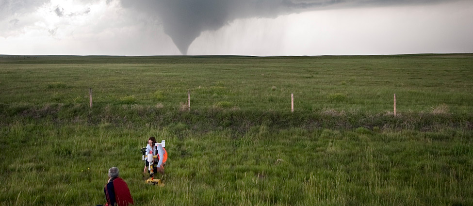
A tornado passes through a field in Goshen County, Wyo., as scientists quickly deploy an instrument pack they hope will be intercepted by the twister.
RYAN MCGINNIS
“Tornadoes devastate South, killing at least 251”
What could be more forceful than this real news headline?
The tornadoes that inspired it.
Tornadoes are nature’s most violent storms, with winds that can exceed 480 kilometers per hour (300 miles per hour). They don’t just toss cars (and sometimes cows). Tragically, tornadoes also kill about 60 people a year in the United States. But that’s just an average. The tornadoes behind the headline were eventually blamed for the deaths of 316 people. All were killed on a single day, April 27, 2011, when a massive storm system spun off hundreds of tornadoes.
Wait, hundreds?
Yes, tornadoes are common, especially in the United States, which records about 1,300 twisters a year. Most strike across a swath of the Great Plains nicknamed “Tornado Alley.” Tornadoes also have been reported on every continent except Antarctica.
The violence of tornadoes drives meteorologists — scientists who study atmospheric events, including weather — to learn more about how, why and when tornadoes form from severe thunderstorms called supercells.
“There is some secret ingredient that causes some of these thunderstorms to make tornadoes, but we don’t know what that secret ingredient is,” says Joshua Wurman. A meteorologist, he is founder of the Center for Severe Weather Research in Boulder, Colo.
What he and other researchers are learning could improve tornado forecasts, provide more accurate advance warnings and, most importantly, save lives.
Recipe for a tornado
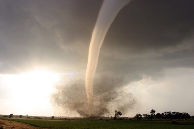
A tornado is a violently rotating column of air extending from the ground to a thunderstorm above. Tornadoes can leave a path of damage up to 1.6 kilometers (1 mile) wide. They can travel more than 160 kilometers (100 miles) over land and last anywhere from minutes to more than an hour.
All tornadoes start with a thunderstorm but require other ingredients too. One is instability. Air is unstable when it is warmer closer to the ground than it is higher up. That warm air will rise, just like a hot-air balloon does.
If that air contains water vapor, the vapor may condense — or transform into droplets — at the cooler temperatures higher up. These droplets may eventually fall as rain or hail. The conversion of water from a gas to a liquid also releases heat. That heat creates strong upward currents of air, called updrafts.
Tornadoes also need wind shear. Wind shear occurs when winds at varying distances above the ground blow in different directions or at different speeds. As the winds blow, a horizontal, invisible tube of rotating air begins to form in the atmosphere. That tube rotates parallel to the ground — picture a giant spinning football or rolling pin.
A strong updraft can eventually lift that rotating tube of air, until it is essentially on end (perpendicular to the ground). Soon, the whole updraft starts to rotate, forming the special kind of thunderstorm known as a supercell. Sometimes, that spinning tightens into a tornado.
(Non-supercell tornadoes form when ground-level winds blowing from different directions set a vertical tube of air spinning. An updraft then stretches that tube, creating a smaller and less violent tornado. When this occurs over water, it is called a waterspout.)
This picture of tornado formation has come into focus over decades of study.
“I actually think we have a good grasp of how tornadoes form … we know a lot more than what we don’t know,” says Paul Markowski, an atmospheric physicist at Pennsylvania State University.
Missing ingredients
Still unknown is why just one in five supercells becomes a tornado.
“To be blunt, we cannot tell the difference between those that will form tornadoes and those that will not,” Wurman says.
All supercells rotate, usually counterclockwise in the northern hemisphere. But a mean-looking, rotating supercell might churn along for an hour before it suddenly makes a tornado.
“We know that the storm has a high potential for tornadoes but we have almost no way of saying precisely when in its life it will intensify its rotation,” says Markowski.
And what causes the supercell’s vertical, rotating column of air to tighten enough to make a tornado?
Scientists understand the recipe for creating a storm, says Jeff Trapp, a Purdue University tornado expert. The big unknown, he says, is what conditions it takes to squeeze a broadly rotating storm cell — what meteorologists call a mesocyclone —into a tornado.
The chase is on
Meteorology requires scientists to make observations and measurements under conditions that are often dangerous. It is not an indoor science.
“We cannot make a tornado in the laboratory, though we do try to do that using computers,” says Wurman. But to truly understand these storms, “We have to go out in the real world, which is why we tornado chase.”
Meteorologists chase tornadoes across the Great Plains each year, typically during the peak season, from March to June. During 1994 and 1995, and again in 2009 to 2010, dozens of those scientists combined their efforts. Their giant field projects were called VORTEX — for the Verification of the Origins of Rotation in Tornadoes Experiment. The second experiment involved more than 100 scientists and students, some as young as 18.
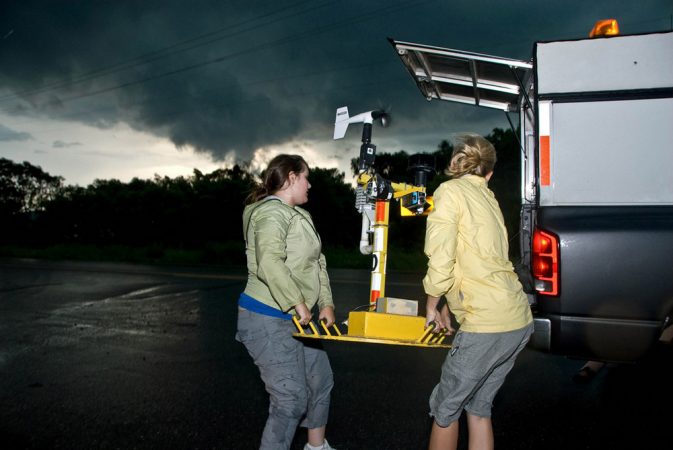
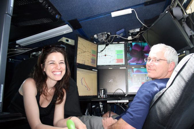
Indeed, that most recent VORTEX project was the largest-ever study of tornado formation. For weeks, a roaming herd of scientists used a flotilla of vehicles and instruments to study supercells and the tornadoes they can spawn.
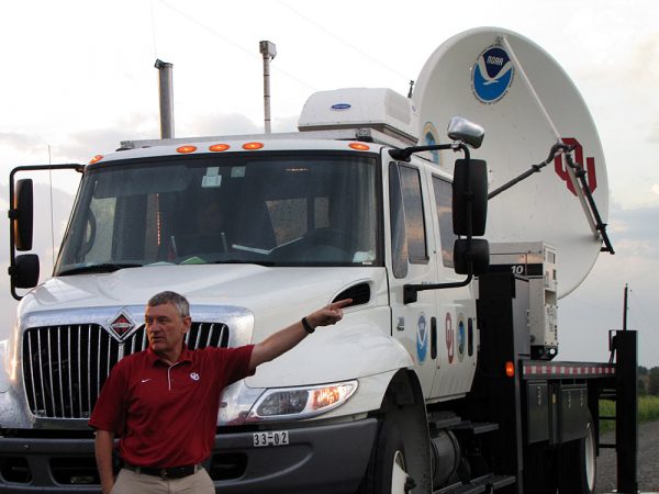
Trucks carried mobile radars to measure wind speeds and directions. Remote-controlled airplanes and balloons measured air temperature, humidity, pressure, wind speed and direction. Back on the ground, miniaturized, car-mounted weather stations did the same. And scientists dropped special probes into the paths of oncoming tornadoes to measure their core winds.
“It’s fair to say tornadoes have never been studied before in this much detail, with this much instrumentation,” says meteorologist Karen Kosiba. A VORTEX2 participant, she works with Wurman at the Center for Severe Weather Research.
During VORTEX2, the scientists measured and observed 25 supercells that made tornadoes — and 25 that did not. So far, the researchers have completed analyses of three of the tornado-producing supercells. They plan to complete in-depth studies of the remaining 47 supercells in coming years. However, their early results already are helping confirm hypotheses, or testable ideas and explanations, about tornado formation.
For example, until about 20 years ago, meteorologists thought a warm updraft lifting a rotating tube of air until it was perpendicular to the ground was enough to make a tornado, says Don Burgess. He’s a meteorologist at the University of Oklahoma in Norman and one of VORTEX2’s main scientists. Thanks to data collected from that project and its predecessor (the original VORTEX project), meteorologists today know that tornado formation isn’t so simple.
Lifting a rotating tube of air will not by itself generate a tornado. Why? Because by the time the rotating tube of air is upright, or vertical, it is high above the ground — not in contact with it. So what conditions will pull that rotation down to the ground? And what squeezes and tightens that vertical column of swirling air into a tornado? Figure skaters pull in their arms to twirl faster. What do supercells do?
Early VORTEX2 findings suggest that the answers may come from the warm, moist air pulled in from a location just ahead and to the right of a supercell, says Burgess.
Ahead of a thunderstorm, a downward rush of cool, dry air flows out over the ground. This is called a “gust front.” (You can feel it as a sudden blast of chilly air as a thunderstorm approaches.) This gust front deflects — or lifts — the warm, moist ground-level air in front of the supercell, VORTEX2 data suggest.
This hoisting of the warm, humid air to about 1 kilometer (0.6 miles) draws it into a swirling, counterclockwise flow pattern. The air speeds up as it twists, says Burgess, formerly of the National Oceanic and Atmospheric Administration’s National Severe Storms Laboratory.
About halfway around the storm, this air is then pushed back toward the ground by a downward current of air. This current is called a rear-flank downdraft. New VORTEX2 analyses suggest that this downdraft further squeezes and compresses the rotating column of air within the supercell, accelerating its twist. The downdraft also shoves that air toward the ground — potentially all of the way to the surface, Burgess notes.
Right there, he says, “is where a tornado is born.”
However, the downdraft has to be just right for the spinning air to form a tornado, notes Markowski, who helped plan VORTEX2. If it is too strong or too weak — no tornado.
At least that’s the picture as it now stands. Will this theory hold as meteorologists pore over their measurements of the other supercells studied during VORTEX2? It may take 10 years to find out, as they complete their analyses of all 50 storms.
Too close for comfort
Of course, meteorologists are focused on the ground for other reasons too. It’s where people live — and where tornadoes inflict their damage.
Surprisingly, meteorologists know very little about tornado winds at ground level. Radar is of limited help because of interference from hills, trees and houses. This technology just cannot give a full, accurate picture.
The only way to measure how powerful and chaotic those winds are is to embed instruments into a twister, explains independent storm chaser Tim Samaras. “That is the piece of the puzzle I bring to the scientific table.”
“Chasing” tornadoes really means getting ahead of them. When the Bennett, Colo.-based Samaras succeeds in getting right in front of a tornado, he drops a steel-encased probe of his own design into the twister’s path. Then he flees, leaving the squat, conical probe to ride out the storm. Instruments inside the device record pressure, humidity, temperature, wind speed and direction.
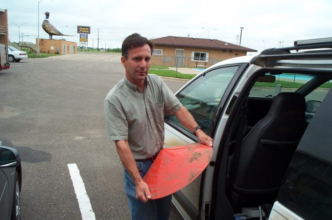
One of his probes clocked tornado winds at 160 kilometers per hour (100 miles per hour) just centimeters (inches) above the ground. Many more measurements, however, are needed to complete the picture.
“You would think it would be obvious, but we don’t know how strong the winds are inside a tornado,” says Wurman, referring especially to the violent, ground-level blowing that causes so much destruction. Nor do meteorologists know which is worse: brief blasts of the fastest winds or the sustained brunt of slower winds.
Unfortunately, hits are less common than misses for storm chasers. For example, Samaras has chased countless tornadoes, but intercepted just 20 or 30. And he has successfully deployed probes right in a tornado’s path only a dozen times.
“The joke is: If you’re trying to get hit by a tornado, it’s really hard to do,” quips Kosiba of the Center for Severe Weather Research.
You’ve been warned
If you don’t want to get hit by a tornado, you can rely on the improved accuracy of tornado warnings. Unfortunately, getting people to pay attention to those warnings remains another twister challenge.
In the 1980s, a warning preceded just one in four tornadoes. Today, the National Weather Service puts out an advance warning for three out of every four tornadoes.
“And if we look only at the 100 or 200 strongest tornadoes each year, 90 to 95 percent of them are warned in advance,” said Harold Brooks. He’s a research meteorologist at the National Severe Storms Laboratory in Norman, Okla.
Of course, there are plenty of false alarms: Three in every four warnings aren’t followed by a tornado.
“If you want to warn about most tornadoes, you have to accept a lot of false alarms,” Brooks notes.
As of 2011, the average advance time for a tornado warning was nearly 15 minutes, according to the National Weather Service. Extending the warning period by even a few minutes could save more lives — if people acted. It pains meteorologists when those in the path of a tornado do not heed their warnings.
“We try to do the best research in the world in terms of how this phenomenon forms and then try to predict it,” says Trapp, the Purdue tornado expert. But if researchers get the public the right information — but fail to get the public to take the right actions — “then we have failed in our mission,” he says.
Earlier this year, the National Weather Service began using much more dramatic language in some tornado warnings. For example, it issued the especially strong caution below for Wichita, Kan., at 10:27 p.m. on April 14.
THIS IS A LIFE THREATENING SITUATION. YOU COULD BE KILLED IF NOT UNDERGROUND OR IN A TORNADO SHELTER. COMPLETE DESTRUCTION OF ENTIRE NEIGHBORHOODS IS LIKELY.
Did the new and stronger language work? It is impossible to judge from just one example. However, no one died.
Word Find (click here to print puzzle)
